
Thank you for supporting this site ❤️
Make a donation
Make a donation
Gear up for your next adventure:
As an Amazon Associate, this site earns from qualifying purchases at no extra cost to you.
Panguipulli topographic map
Click on the map to display elevation.
Thank you for supporting this site ❤️
Make a donation
Make a donation
Gear up for your next adventure:
As an Amazon Associate, this site earns from qualifying purchases at no extra cost to you.
About this map
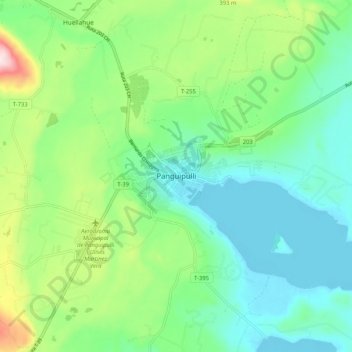
Name: Panguipulli topographic map, elevation, terrain.
Location: Panguipulli, Provincia de Valdivia, Los Ríos Region, Chile (-39.68199 -72.37338 -39.60199 -72.29338)
Average elevation: 226 m
Minimum elevation: 126 m
Maximum elevation: 488 m
Thank you for supporting this site ❤️
Make a donation
Make a donation
Gear up for your next adventure:
As an Amazon Associate, this site earns from qualifying purchases at no extra cost to you.