Geolocate

Madla topographic map

Click on the map to display elevation.

About this map

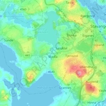
Name: Madla topographic map, elevation, terrain.

Location: Madla, Stavanger, Rogaland, Norway (58.92743 5.56563 58.97906 5.69372)

Average elevation: 28 m

Minimum elevation: -2 m

Maximum elevation: 131 m

Other topographic maps

Click on a map to view its topography, its elevation and its terrain.

Sjernarøy

Norway > Rogaland > Stavanger

Average elevation: 9 m

Byhaugen

Norway > Rogaland > Stavanger

Average elevation: 35 m

Gear up for your next adventure:

🥤Outdoor Water Bottles - Reusable bottles for outdoor activities
🔋Solar Power Banks - Charge your phone and GPS using the sun while deep in the bush
🔋Solar Power Banks - Solar chargers for outdoors
🌧️Rain Jackets - Waterproof jackets for hiking
📻Handheld UHF Radios - Critical communication for groups in the Australian outback

As an Amazon Associate, this site earns from qualifying purchases at no extra cost to you.