
Fuente Dé topographic map
Interactive map
Click on the map to display elevation.
About this map
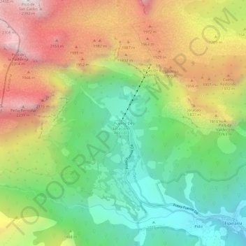
Name: Fuente Dé topographic map, elevation, terrain.
Location: Fuente Dé, Camaleño, Kantabrien, 39588, Spanien (43.12403 -4.83148 43.16403 -4.79148)
Average elevation: 1,505 m
Minimum elevation: 853 m
Maximum elevation: 2,378 m
Fuente Dé ist ein Ortsteil der spanischen Gemeinde Camaleño in der autonomen Gemeinschaft Kantabrien. Der Ort zählt zum Nationalpark Picos de Europa, er liegt auf rund 1100 m Höhe in einem nach Süden offenen Talkessel, der halbrund von bis zu 300 m hohen Felswänden umgeben ist. Die besondere Lage macht ihn sowohl für Touristen als auch für Geomorphologen interessant. Das spanische Wort „Fuente“ bedeutet „Quelle“, in Fuente Dé entspringt der Fluss Río Deva.