
Brsečine topographic map
Interactive map
Click on the map to display elevation.
About this map
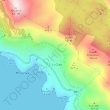
Name: Brsečine topographic map, elevation, terrain.
Average elevation: 240 m
Minimum elevation: 0 m
Maximum elevation: 622 m
Other topographic maps
Click on a map to view its topography, its elevation and its terrain.
Dubrovnik
Kroatien > Gespanschaft Dubrovnik-Neretva > Grad Dubrovnik
Dubrovnik, Grad Dubrovnik, Gespanschaft Dubrovnik-Neretva, Kroatien
Average elevation: 65 m