
Heidersbach topographic map
Interactive map
Click on the map to display elevation.
About this map
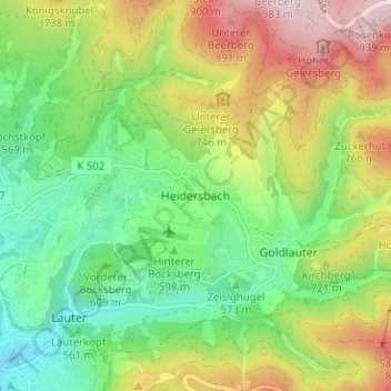
Name: Heidersbach topographic map, elevation, terrain.
Location: Heidersbach, Suhl, Thüringen, 98528, Deutschland (50.61595 10.71124 50.65595 10.75124)
Average elevation: 645 m
Minimum elevation: 452 m
Maximum elevation: 948 m