
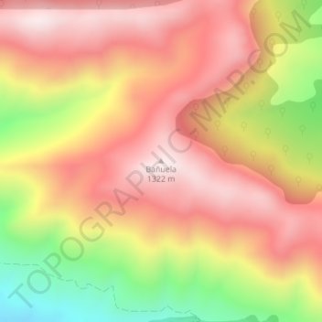
Bañuela topographic map
Interactive map
Click on the map to display elevation.
About this map
Name: Bañuela topographic map, elevation, terrain.
Average elevation: 1,070 m
Minimum elevation: 687 m
Maximum elevation: 1,319 m
Other topographic maps
Click on a map to view its topography, its elevation and its terrain.
Fuencaliente
España > Castilla-La Mancha > Sierra Morena > Fuencaliente
Fuencaliente, Sierra Morena, Ciudad Real, Castilla-La Mancha, España
Average elevation: 764 m
Ventillas
España > Castilla-La Mancha > Sierra Morena > Fuencaliente > Ventillas
Ventillas, Fuencaliente, Sierra Morena, Ciudad Real, Castilla-La Mancha, España
Average elevation: 776 m