
Pueblo Viejo topographic map
Interactive map
Click on the map to display elevation.
About this map
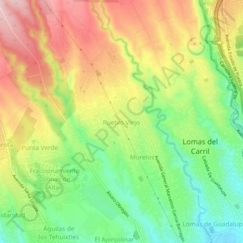
Name: Pueblo Viejo topographic map, elevation, terrain.
Location: Pueblo Viejo, Temixco, Morelos, 62588, México (18.84732 -99.26643 18.88732 -99.22643)
Average elevation: 1,351 m
Minimum elevation: 1,237 m
Maximum elevation: 1,476 m
Other topographic maps
Click on a map to view its topography, its elevation and its terrain.
Lázaro Cárdenas del Río
Lázaro Cárdenas del Río, Temixco, Morelos, 62587, México
Average elevation: 1,260 m
San Agustín Tetlama
San Agustín Tetlama, Temixco, Morelos, 62595, México
Average elevation: 1,254 m