
Gahinga topographic map
Interactive map
Click on the map to display elevation.
About this map
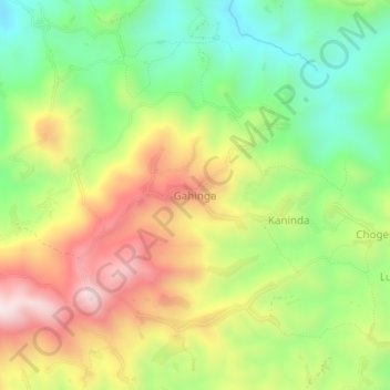
Name: Gahinga topographic map, elevation, terrain.
Location: Gahinga, Bashali, Masisi, Nord-Kivu, RD Congo (-1.20893 28.86677 -1.16893 28.90677)
Average elevation: 1,962 m
Minimum elevation: 1,676 m
Maximum elevation: 2,321 m