Geolocate

Moffet topographic map

Click on the map to display elevation.

About this map
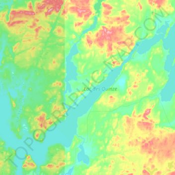
Name: Moffet topographic map, elevation, terrain.

Location: Moffet, Témiscamingue, Abitibi-Témiscamingue, Quebec, J0Z 2W0, Canada (47.46339 -79.06620 47.70335 -78.70963)

Average elevation: 294 m

Minimum elevation: 258 m

Maximum elevation: 386 m

Other topographic maps

Click on a map to view its topography, its elevation and its terrain.

Winneway

Canada > Quebec > Témiscamingue

Average elevation: 288 m

Tee Lake

Canada > Quebec > Témiscamingue

Average elevation: 280 m

Gear up for your next adventure:

⌚GPS Watches - GPS watches for outdoor sports
🥶Thermal Beanies - Warm hats for cold hikes
⌛Survival Blankets - Emergency thermal blankets
🪑Portable Backpacking Chairs - A comfortable seat for studying maps at the end of the day
⌚Altimeter Barometer Watches - Outdoor watches with built-in sensors to track altitude changes and weather shifts

As an Amazon Associate, this site earns from qualifying purchases at no extra cost to you.