
Thank you for supporting this site ❤️
Make a donation
Make a donation
Gear up for your next adventure:
As an Amazon Associate, this site earns from qualifying purchases at no extra cost to you.
Thyon topographic map
Click on the map to display elevation.
Thank you for supporting this site ❤️
Make a donation
Make a donation
Gear up for your next adventure:
As an Amazon Associate, this site earns from qualifying purchases at no extra cost to you.
About this map
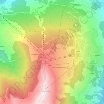
Name: Thyon topographic map, elevation, terrain.
Location: Thyon, Vex, Hérens, Valais, 2305, Suisse (46.16105 7.35178 46.20105 7.39178)
Average elevation: 1,737 m
Minimum elevation: 1,067 m
Maximum elevation: 2,448 m
Thank you for supporting this site ❤️
Make a donation
Make a donation
Gear up for your next adventure:
As an Amazon Associate, this site earns from qualifying purchases at no extra cost to you.