Geolocate

Ashen topographic map

Click on the map to display elevation.

About this map

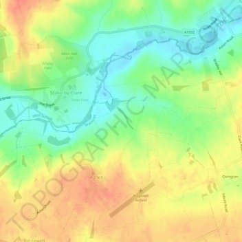
Name: Ashen topographic map, elevation, terrain.

Location: Ashen, Braintree, Essex, England, United Kingdom (52.04282 0.52962 52.07585 0.58672)

Average elevation: 69 m

Minimum elevation: 44 m

Maximum elevation: 92 m

Gear up for your next adventure:

🔪Camping Knives - Multi-purpose outdoor knives
👕UPF 50+ Sun Shirts - Essential protection against the harsh Australian sun during field work
🧰Survival Kits - Essential survival gear
📚Map Reading & Navigation Guides - Master the art of interpreting topographic contours and symbols
🦟Heavy Duty Insect Repellent - Essential protection against flies, mozzies, and march flies

As an Amazon Associate, this site earns from qualifying purchases at no extra cost to you.