
Thank you for supporting this site ❤️
Make a donation
Make a donation
Gear up for your next adventure:
As an Amazon Associate, this site earns from qualifying purchases at no extra cost to you.
97799 topographic map
Click on the map to display elevation.
Thank you for supporting this site ❤️
Make a donation
Make a donation
Gear up for your next adventure:
As an Amazon Associate, this site earns from qualifying purchases at no extra cost to you.
About this map
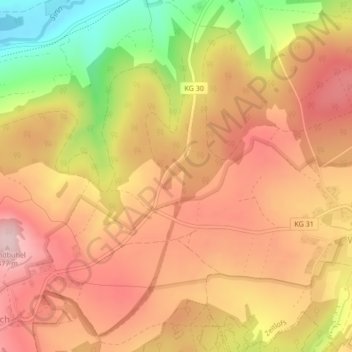
Name: 97799 topographic map, elevation, terrain.
Location: 97799, Zeitlofs, Landkreis Bad Kissingen, Bayern, Deutschland (50.25171 9.70459 50.25181 9.70469)
Average elevation: 388 m
Minimum elevation: 241 m
Maximum elevation: 478 m
Thank you for supporting this site ❤️
Make a donation
Make a donation
Gear up for your next adventure:
As an Amazon Associate, this site earns from qualifying purchases at no extra cost to you.