Geolocate

Ozark topographic map

Click on the map to display elevation.

About this map

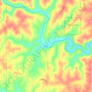
Name: Ozark topographic map, elevation, terrain.

Location: Ozark, Jackson County, Iowa, United States (42.17529 -90.89542 42.21529 -90.85542)

Average elevation: 266 m

Minimum elevation: 222 m

Maximum elevation: 299 m

Other topographic maps

Click on a map to view its topography, its elevation and its terrain.

Miles

United States > Iowa > Jackson County

Average elevation: 248 m

Gear up for your next adventure:

🎨Portable Watercolor Kits - Paint the landscapes and topographic views you discover
🦘Outback Survival Gear - Essential gear for Australian outback
🔋Solar Power Banks - Charge your phone and GPS using the sun while deep in the bush
📡Weather Radios - Emergency weather radios
🧢Wide Brim Sun Hats - Maximum coverage for the face and neck while out in the open

As an Amazon Associate, this site earns from qualifying purchases at no extra cost to you.