
Thank you for supporting this site ❤️
Make a donation
Make a donation
Gear up for your next adventure:
As an Amazon Associate, this site earns from qualifying purchases at no extra cost to you.
Nebelhorn topographic map
Click on the map to display elevation.
Thank you for supporting this site ❤️
Make a donation
Make a donation
Gear up for your next adventure:
As an Amazon Associate, this site earns from qualifying purchases at no extra cost to you.
About this map
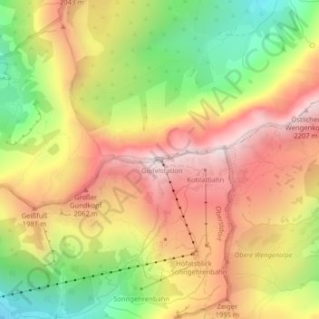
Name: Nebelhorn topographic map, elevation, terrain.
Location: Nebelhorn, Oberstdorf, Landkreis Oberallgäu, Bavaria, Germany (47.42182 10.34230 47.42192 10.34240)
Average elevation: 1,792 m
Minimum elevation: 1,318 m
Maximum elevation: 2,209 m
Thank you for supporting this site ❤️
Make a donation
Make a donation
Gear up for your next adventure:
As an Amazon Associate, this site earns from qualifying purchases at no extra cost to you.