
Grover Hill topographic map
Interactive map
Click on the map to display elevation.
About this map
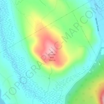
Name: Grover Hill topographic map, elevation, terrain.
Location: Grover Hill, Oxford County, Maine, 04217, United States (44.37168 -70.77012 44.37178 -70.77002)
Average elevation: 249 m
Minimum elevation: 198 m
Maximum elevation: 369 m
Other topographic maps
Click on a map to view its topography, its elevation and its terrain.
Boston Hills
United States > Maine > Oxford County > Denmark
Boston Hills, Denmark, Oxford County, Maine, 04022, United States
Average elevation: 136 m
Grafton Township
United States > Maine > Oxford County
Grafton Township, Oxford County, Maine, 04261, United States
Average elevation: 632 m
Mooselookmeguntic Lake
United States > Maine > Oxford County > Adamstown Township
Mooselookmeguntic Lake, Adamstown Township, Oxford County, Maine, United States
Average elevation: 508 m
Roxbury
United States > Maine > Oxford County
Roxbury, Oxford County, Maine, 04275, United States
Average elevation: 379 m
West Paris
United States > Maine > Oxford County
West Paris, Oxford County, Maine, 04289, United States
Average elevation: 234 m
Newry
United States > Maine > Oxford County
Newry, Oxford County, Maine, 04261, United States
Average elevation: 392 m
Andover
United States > Maine > Oxford County
Andover, Oxford County, Maine, 04216, United States
Average elevation: 381 m
Aziscohos Lake
United States > Maine > Oxford County
Aziscohos Lake, Oxford County, Maine, United States
Average elevation: 589 m
Old Speck Mountain
United States > Maine > Oxford County
Old Speck Mountain, Oxford County, Maine, United States
Average elevation: 943 m
Rumford
United States > Maine > Oxford County
Rumford, Oxford County, Maine, 04276, United States
Average elevation: 280 m
Record Hill
United States > Maine > Oxford County > Byron
Record Hill, Byron, Oxford County, Maine, 04275, United States
Average elevation: 477 m
Otisfield
United States > Maine > Oxford County
Otisfield, Oxford County, Maine, 04270, United States
Average elevation: 142 m
West Bethel
United States > Maine > Oxford County > Bethel
West Bethel, Bethel, Oxford County, Maine, 04217, United States
Average elevation: 252 m
Norway
United States > Maine > Oxford County > Norway
Norway, Oxford County, Maine, 04268, United States
Average elevation: 180 m
Sunday River
United States > Maine > Oxford County > Bethel
Sunday River, Bethel, Oxford County, Maine, 04217, United States
Average elevation: 279 m
Sumner
United States > Maine > Oxford County
Sumner, Oxford County, Maine, 04292, United States
Average elevation: 223 m
Hartford
United States > Maine > Oxford County
Hartford, Oxford County, Maine, 04220, United States
Average elevation: 192 m
Greenwood
United States > Maine > Oxford County
Greenwood, Oxford County, Maine, 04255, United States
Average elevation: 295 m
Byron
United States > Maine > Oxford County
Byron, Oxford County, Maine, 04275, United States
Average elevation: 492 m
Paris
United States > Maine > Oxford County
Paris, Oxford County, Maine, 04281, United States
Average elevation: 207 m
Stow
United States > Maine > Oxford County
Stow, Oxford County, Maine, 04037, United States
Average elevation: 308 m
Lovell
United States > Maine > Oxford County
Lovell, Oxford County, Maine, 04051, United States
Average elevation: 187 m
Upton
United States > Maine > Oxford County
Upton, Oxford County, Maine, 04261, United States
Average elevation: 448 m
Dixfield
United States > Maine > Oxford County
Dixfield, Oxford County, Maine, 04224, United States
Average elevation: 233 m
South Paris
United States > Maine > Oxford County > Paris
South Paris, Paris, Oxford County, Maine, 04281, United States
Average elevation: 155 m
Oxford
United States > Maine > Oxford County
Oxford, Oxford County, Maine, 04270, United States
Average elevation: 144 m
Buckfield
United States > Maine > Oxford County
Buckfield, Oxford County, Maine, 04220, United States
Average elevation: 187 m
Peru
United States > Maine > Oxford County
Peru, Oxford County, Maine, 04290, United States
Average elevation: 238 m
Porter
United States > Maine > Oxford County
Porter, Oxford County, Maine, 04068, United States
Average elevation: 197 m
Hiram
United States > Maine > Oxford County
Hiram, Oxford County, Maine, 04041, United States
Average elevation: 178 m
Bethel
United States > Maine > Oxford County
Bethel, Oxford County, Maine, 04217, United States
Average elevation: 310 m
Mexico
United States > Maine > Oxford County > Mexico
Mexico, Oxford County, Maine, 04257, United States
Average elevation: 270 m
Sugarloaf
United States > Maine > Oxford County > Dixfield
Sugarloaf, Dixfield, Oxford County, Maine, 04224, United States
Average elevation: 237 m
Woodstock
United States > Maine > Oxford County > Woodstock
Woodstock, Oxford County, Maine, 04219, United States
Average elevation: 316 m
Gilead
United States > Maine > Oxford County
Gilead, Oxford County, Maine, 04217, United States
Average elevation: 430 m
Fryeburg
United States > Maine > Oxford County
Fryeburg, Oxford County, Maine, 04037, United States
Average elevation: 200 m
Denmark
United States > Maine > Oxford County
Denmark, Oxford County, Maine, 04022, United States
Average elevation: 174 m
Sweden
United States > Maine > Oxford County
Sweden, Oxford County, Maine, 04040, United States
Average elevation: 185 m
Brownfield
United States > Maine > Oxford County > Brownfield
Brownfield, Oxford County, Maine, 04010, United States
Average elevation: 170 m
Canton
United States > Maine > Oxford County
Canton, Oxford County, Maine, 04221, United States
Average elevation: 203 m