Geolocate

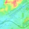
Eastpointe topographic map

Click on the map to display elevation.

About this map

Name: Eastpointe topographic map, elevation, terrain.

Location: Eastpointe, Birmingham, Jefferson County, Alabama, 35217, United States (33.57288 -86.75666 33.61288 -86.71666)

Average elevation: 216 m

Minimum elevation: 128 m

Maximum elevation: 265 m

Other topographic maps

Click on a map to view its topography, its elevation and its terrain.
Gear up for your next adventure:

🛌Compact Down Sleeping Bags - Warmth without the bulk, ideal for backcountry camping
🥾Hiking Shoes - Lightweight hiking shoes for day hikes
🪫Rechargeable Headlamps - USB rechargeable headlamps
🧦Hiking Socks - Comfortable socks for long hikes
🦯Adjustable Trekking Poles - Reduce impact on knees when descending steep topographic ridges

As an Amazon Associate, this site earns from qualifying purchases at no extra cost to you.