
Thank you for supporting this site ❤️
Make a donation
Make a donation
Gear up for your next adventure:
As an Amazon Associate, this site earns from qualifying purchases at no extra cost to you.
Helmstedt topographic map
Click on the map to display elevation.
Thank you for supporting this site ❤️
Make a donation
Make a donation
Gear up for your next adventure:
As an Amazon Associate, this site earns from qualifying purchases at no extra cost to you.
About this map
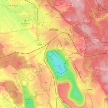
Name: Helmstedt topographic map, elevation, terrain.
Location: Helmstedt, Landkreis Helmstedt, Lower Saxony, 38350, Germany (52.17537 10.93892 52.24748 11.04518)
Average elevation: 137 m
Minimum elevation: 37 m
Maximum elevation: 193 m
Thank you for supporting this site ❤️
Make a donation
Make a donation
Gear up for your next adventure:
As an Amazon Associate, this site earns from qualifying purchases at no extra cost to you.