Geolocate

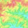
Royal Tunbridge Wells topographic map

Click on the map to display elevation.

About this map

Name: Royal Tunbridge Wells topographic map, elevation, terrain.

Location: Royal Tunbridge Wells, Tunbridge Wells, Kent, England, TN1 2DL, United Kingdom (51.09715 0.22734 51.17715 0.30734)

Average elevation: 99 m

Minimum elevation: 27 m

Maximum elevation: 181 m

Other topographic maps

Click on a map to view its topography, its elevation and its terrain.

Frittenden

United Kingdom > England > Kent > Tunbridge Wells

Average elevation: 34 m

Hawkhurst

United Kingdom > England > Kent > Tunbridge Wells

Average elevation: 67 m

Paddock Wood

United Kingdom > England > Kent > Tunbridge Wells

Average elevation: 33 m

Goudhurst

United Kingdom > England > Kent > Tunbridge Wells > Goudhurst

Average elevation: 76 m

Benenden

United Kingdom > England > Kent > Tunbridge Wells

Average elevation: 61 m

Pembury

United Kingdom > England > Kent > Tunbridge Wells

Average elevation: 99 m

Bidborough

United Kingdom > England > Kent > Tunbridge Wells

Average elevation: 71 m

Horsmonden

United Kingdom > England > Kent > Tunbridge Wells > Horsmonden

Average elevation: 51 m

Speldhurst

United Kingdom > England > Kent > Tunbridge Wells

Average elevation: 89 m

Rusthall

United Kingdom > England > Kent > Tunbridge Wells > Rusthall

Average elevation: 100 m

Capel

United Kingdom > England > Kent > Tunbridge Wells

Average elevation: 47 m

Hurst Wood

United Kingdom > England > Kent > Tunbridge Wells > Rusthall

Average elevation: 101 m

Speldhurst

United Kingdom > England > Kent > Tunbridge Wells

Average elevation: 89 m

Benenden

United Kingdom > England > Kent > Tunbridge Wells > Benenden

Average elevation: 61 m

Hawkhurst

United Kingdom > England > Kent > Tunbridge Wells

Average elevation: 67 m

Benenden

United Kingdom > England > Kent > Tunbridge Wells

Average elevation: 61 m

Goudhurst

United Kingdom > England > Kent > Tunbridge Wells

Average elevation: 76 m

Paddock Wood

United Kingdom > England > Kent > Tunbridge Wells > Whetsted

Average elevation: 33 m

Capel

United Kingdom > England > Kent > Tunbridge Wells

Average elevation: 47 m

Gear up for your next adventure:

🧰Survival Kits - Essential survival gear
📣High-Decibel Survival Whistles - Signaling tool for rescue that carries much further than a human voice
🔪Camping Knives - Multi-purpose outdoor knives
🔪Multitools - Compact tools for outdoor use
🧢Outdoor Sun Hats - Sun protection hats for hiking

As an Amazon Associate, this site earns from qualifying purchases at no extra cost to you.