
Limbang River topographic map
Interactive map
Click on the map to display elevation.
About this map
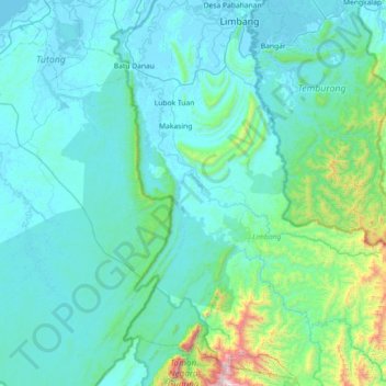
Name: Limbang River topographic map, elevation, terrain.
Location: Limbang River, Sarawak, Malaysia (4.07326 114.81691 4.79222 115.31741)
Average elevation: 184 m
Minimum elevation: -2 m
Maximum elevation: 1,911 m
Other topographic maps
Click on a map to view its topography, its elevation and its terrain.