
Jurau topographic map
Interactive map
Click on the map to display elevation.
About this map
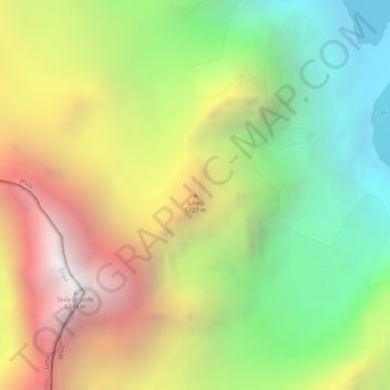
Name: Jurau topographic map, elevation, terrain.
Location: Jurau, Jesús, Lauricocha, Huánuco, Perú (-10.28806 -76.88329 -10.28796 -76.88319)
Average elevation: 5,253 m
Minimum elevation: 4,279 m
Maximum elevation: 6,321 m
Other topographic maps
Click on a map to view its topography, its elevation and its terrain.
Laguna Viconga
Laguna Viconga, Circuito de Huayhuash, Jesús, Lauricocha, Huánuco, Perú
Average elevation: 4,570 m