Geolocate

Bolhoon topographic map

Click on the map to display elevation.

About this map

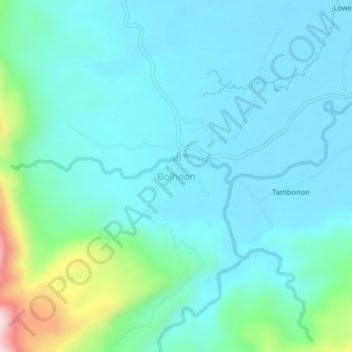
Name: Bolhoon topographic map, elevation, terrain.

Location: Bolhoon, San Miguel, Surigao del Sur, Caraga, Philippines (8.84239 125.95452 8.88239 125.99452)

Average elevation: 92 m

Minimum elevation: 12 m

Maximum elevation: 477 m

Gear up for your next adventure:

🔦Headlamps - Hands-free lighting for hiking
🕯️Emergency Whistles - Safety whistles for hiking
🥾Trail Running Shoes - Shoes for trail running
🏃Compression Recovery Socks - Reduce leg fatigue after heavy days of elevation gain
📸Action Cameras - Record your journey across interesting topographic features in 4K

As an Amazon Associate, this site earns from qualifying purchases at no extra cost to you.