
Puerres topographic map
Interactive map
Click on the map to display elevation.
About this map
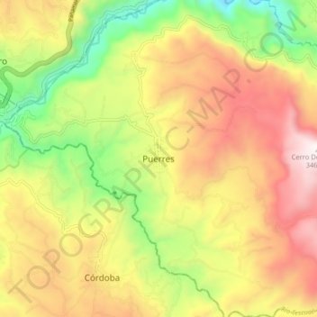
Name: Puerres topographic map, elevation, terrain.
Location: Puerres, Nariño, Colômbia (0.84351 -77.54368 0.92351 -77.46368)
Average elevation: 2,795 m
Minimum elevation: 2,135 m
Maximum elevation: 3,457 m