
天目湖镇 topographic map
Interactive map
Click on the map to display elevation.
About this map
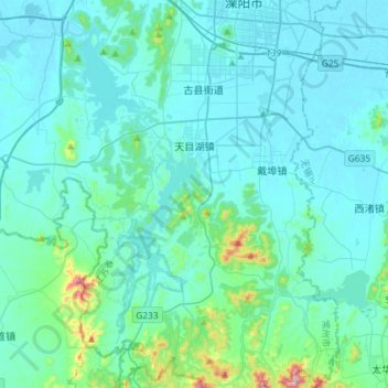
Name: 天目湖镇 topographic map, elevation, terrain.
Location: 天目湖镇, 溧阳市, 常州市, 江苏省, 213300, 中国 (31.17027 119.32660 31.41867 119.48330)
Average elevation: 49 m
Minimum elevation: 2 m
Maximum elevation: 465 m
Other topographic maps
Click on a map to view its topography, its elevation and its terrain.