Geolocate

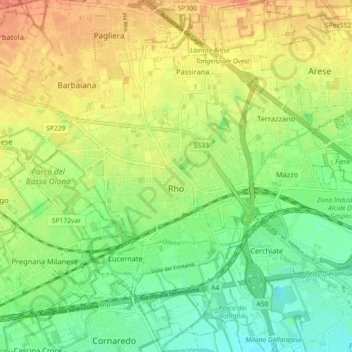
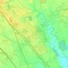
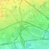
Rho topographic map

Click on the map to display elevation.

Rho

The current topography can be traced to a style of organization from ancient Roman centuriation: the most of the roads run parallel in east-west or north–south directions. The reference axis are the cardo (north–south, via Madonna and via Garibaldi) and the Decumano (east–west, via Matteotti and via Porta Ronca). These roads are crossing in piazza San Vittore, nowadays still the center of the town.

Wikipedia (CC-BY-SA 3.0)

About this map

Name: Rho topographic map, elevation, terrain.

Location: Rho, Milan, Lombardy, 20017, Italy (45.50234 9.00648 45.55975 9.09637)

Average elevation: 158 m

Minimum elevation: 137 m

Maximum elevation: 181 m

Other topographic maps

Click on a map to view its topography, its elevation and its terrain.

Monte Stella

Italy > Lombardy > Milan > Milan

Average elevation: 134 m

Fagnano

Italy > Lombardy > Milan > San Vito

Average elevation: 120 m

Castelletto di Cuggiono

Italy > Lombardy > Milan

Average elevation: 142 m

Zivido

Italy > Lombardy > Milan > San Giuliano Milanese

Average elevation: 94 m

Mazzo

Italy > Lombardy > Milan > Rho

Average elevation: 155 m

Ospiate

Italy > Lombardy > Milan > Bollate

Average elevation: 156 m

Mariotto

Italy > Lombardy > Milan > San Colombano al Lambro

Average elevation: 62 m

Pantanedo

Italy > Lombardy > Milan > Rho > Mazzo

Average elevation: 153 m

Cascina Confaloniera

Italy > Lombardy > Milan > Rosate

Average elevation: 107 m

San Pietro all'Olmo

Italy > Lombardy > Milan > Cornaredo

Average elevation: 142 m

Gear up for your next adventure:

📕Australia Maps - Maps covering Australian regions
🔌Fast Charging Adapters - Quickly top up all your gear before heading back into the field
🔋Solar Power Banks - Solar chargers for outdoors
🎒Dry Bags - Waterproof bags for outdoor gear
🪢550 Survival Paracord - Versatile cordage for gear repair and emergency lashing

As an Amazon Associate, this site earns from qualifying purchases at no extra cost to you.