
怡心湖 topographic map
Interactive map
Click on the map to display elevation.
About this map
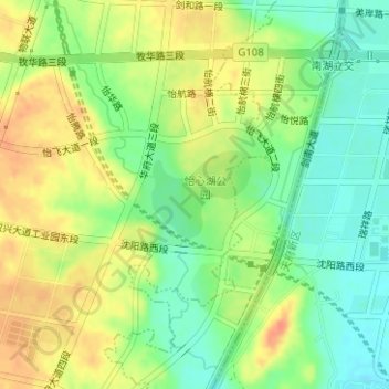
Name: 怡心湖 topographic map, elevation, terrain.
Location: 怡心湖, 双流区, 成都市, 四川省, 中国 (30.47533 104.01540 30.48143 104.02340)
Average elevation: 484 m
Minimum elevation: 461 m
Maximum elevation: 507 m
Other topographic maps
Click on a map to view its topography, its elevation and its terrain.