
Crizbav topographic map
Interactive map
Click on the map to display elevation.
Crizbav
The Crizbav commune altitude is 572 m, decreasing to Feldioara and Satu Nou at 513–514 m. Higher elevations in the commune are Horezu Peak-1055 m and Citadel Peak-1104 m, both arranged in the foothills of Perșani Mountains, approximately 6 km to the village center.
About this map
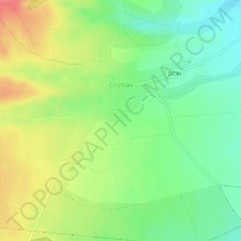
Name: Crizbav topographic map, elevation, terrain.
Location: Crizbav, Brașov, 507081, Romania (45.80334 25.45302 45.81887 25.48369)
Average elevation: 573 m
Minimum elevation: 543 m
Maximum elevation: 612 m