
Farve topographic map
Interactive map
Click on the map to display elevation.
About this map
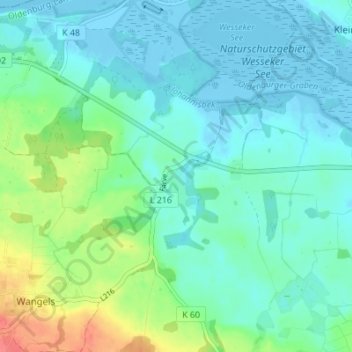
Name: Farve topographic map, elevation, terrain.
Average elevation: 14 m
Minimum elevation: -7 m
Maximum elevation: 59 m
Other topographic maps
Click on a map to view its topography, its elevation and its terrain.
Hohwachter Bucht
Deutschland > Schleswig-Holstein > Ostholstein > Wangels
Hohwachter Bucht, Wangels, Oldenburg-Land, Ostholstein, Schleswig-Holstein, Deutschland
Average elevation: 8 m