
Kagandu topographic map
Interactive map
Click on the map to display elevation.
About this map
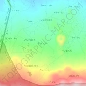
Name: Kagandu topographic map, elevation, terrain.
Location: Kagandu, Kisoro, Western Region, Uganda (-1.35500 29.60309 -1.31500 29.64309)
Average elevation: 2,179 m
Minimum elevation: 2,036 m
Maximum elevation: 2,435 m
Other topographic maps
Click on a map to view its topography, its elevation and its terrain.
Bwindi Impenetrable National Park
Bwindi Impenetrable National Park, Mpungu Sub-County, Kisoro, Western Region, Uganda
Average elevation: 1,643 m