
Thank you for supporting this site ❤️
Make a donation
Make a donation
Gear up for your next adventure:
As an Amazon Associate, this site earns from qualifying purchases at no extra cost to you.
Phonsavan topographic map
Click on the map to display elevation.
Thank you for supporting this site ❤️
Make a donation
Make a donation
Gear up for your next adventure:
As an Amazon Associate, this site earns from qualifying purchases at no extra cost to you.
About this map
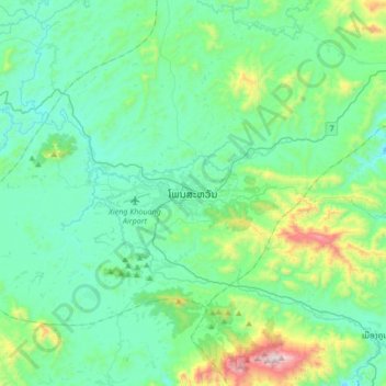
Name: Phonsavan topographic map, elevation, terrain.
Location: Phonsavan, Pek District, Xiangkhouang Province, Laos (19.29189 103.04661 19.61189 103.36661)
Average elevation: 1,198 m
Minimum elevation: 994 m
Maximum elevation: 2,100 m
Thank you for supporting this site ❤️
Make a donation
Make a donation
Gear up for your next adventure:
As an Amazon Associate, this site earns from qualifying purchases at no extra cost to you.