
Jadis topographic map
Interactive map
Click on the map to display elevation.
About this map
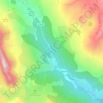
Name: Jadis topographic map, elevation, terrain.
Average elevation: 2,236 m
Minimum elevation: 1,783 m
Maximum elevation: 2,895 m
Other topographic maps
Click on a map to view its topography, its elevation and its terrain.
Laval
France > Provence-Alpes-Côte d'Azur > Hautes-Alpes > Névache
Laval, Névache, Briançon, Hautes-Alpes, Provence-Alpes-Côte d'Azur, Metropolitan France, 05100, France
Average elevation: 2,356 m