
Heyd topographic map
Interactive map
Click on the map to display elevation.
About this map
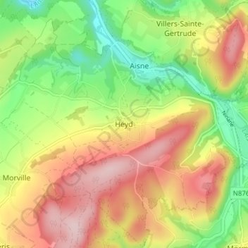
Name: Heyd topographic map, elevation, terrain.
Location: Heyd, Durbuy, Marche-en-Famenne, Luxemburg, Wallonië, België (50.32645 5.54216 50.36645 5.58216)
Average elevation: 265 m
Minimum elevation: 147 m
Maximum elevation: 389 m