
San Alberto topographic map
Interactive map
Click on the map to display elevation.
About this map
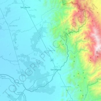
Name: San Alberto topographic map, elevation, terrain.
Location: San Alberto, Cesar, Colombia (7.67639 -73.66939 7.99336 -73.27553)
Average elevation: 569 m
Minimum elevation: 48 m
Maximum elevation: 3,554 m
Other topographic maps
Click on a map to view its topography, its elevation and its terrain.