Geolocate

Cromwell topographic map

Click on the map to display elevation.

About this map

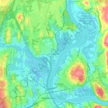
Name: Cromwell topographic map, elevation, terrain.

Location: Cromwell, Middlesex County, Connecticut, 06480, USA (41.55499 -72.68557 41.63499 -72.60557)

Average elevation: 31 m

Minimum elevation: -3 m

Maximum elevation: 120 m

Gear up for your next adventure:

🧤Hiking Gloves - Protective gloves for outdoor use
🔦LED Torches - LED torches for outdoor use
📷Backpack Camera Clips - Quick access to your camera while keeping your hands free for climbing
🔭Compact Hiking Binoculars - Lightweight optics for scouting routes or birdwatching
Survival Blankets - Emergency thermal blankets

As an Amazon Associate, this site earns from qualifying purchases at no extra cost to you.