
Thank you for supporting this site ❤️
Make a donation
Make a donation
Gear up for your next adventure:
As an Amazon Associate, this site earns from qualifying purchases at no extra cost to you.
内黄 topographic map
Click on the map to display elevation.
Thank you for supporting this site ❤️
Make a donation
Make a donation
Gear up for your next adventure:
As an Amazon Associate, this site earns from qualifying purchases at no extra cost to you.
About this map
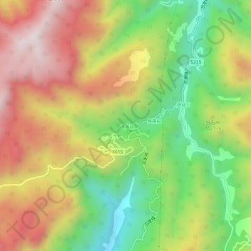
Name: 内黄 topographic map, elevation, terrain.
Location: 内黄, Suichang County, Lishui, Zhejiang, China (28.34160 119.12731 28.38160 119.16731)
Average elevation: 970 m
Minimum elevation: 533 m
Maximum elevation: 1,434 m
Thank you for supporting this site ❤️
Make a donation
Make a donation
Gear up for your next adventure:
As an Amazon Associate, this site earns from qualifying purchases at no extra cost to you.