
Gemeinde Strömstad topographic map
Interactive map
Click on the map to display elevation.
About this map
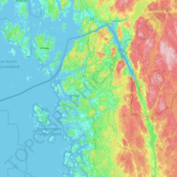
Name: Gemeinde Strömstad topographic map, elevation, terrain.
Average elevation: 45 m
Minimum elevation: -1 m
Maximum elevation: 250 m
Other topographic maps
Click on a map to view its topography, its elevation and its terrain.
Lefstad
Schweden > Provinz Västra Götaland > Lefstad
Lefstad, Gemeinde Kungälv, Provinz Västra Götaland, Landesteil Götaland, 44295, Schweden
Average elevation: 35 m