
Angeja topographic map
Interactive map
Click on the map to display elevation.
About this map
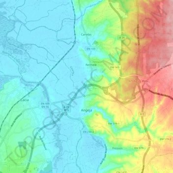
Name: Angeja topographic map, elevation, terrain.
Location: Angeja, Albergaria-a-Velha, Aveiro, Portugal (40.65360 -8.63243 40.72698 -8.51809)
Average elevation: 42 m
Minimum elevation: -1 m
Maximum elevation: 145 m