
Glenwood topographic map
Interactive map
Click on the map to display elevation.
About this map
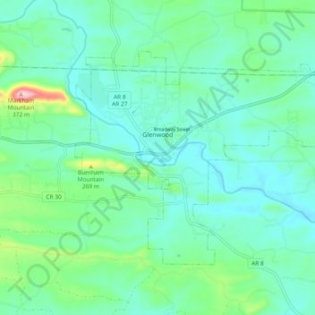
Name: Glenwood topographic map, elevation, terrain.
Location: Glenwood, Pike County, Arkansas, 71943, United States (34.29446 -93.57153 34.34642 -93.47869)
Average elevation: 193 m
Minimum elevation: 150 m
Maximum elevation: 358 m