
Basse-Terre topographic map
Interactive map
Click on the map to display elevation.
About this map
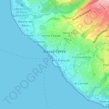
Name: Basse-Terre topographic map, elevation, terrain.
Location: Basse-Terre, Guadeloupe, 97100, France (15.98560 -61.74616 16.01265 -61.71245)
Average elevation: 45 m
Minimum elevation: 0 m
Maximum elevation: 253 m
Other topographic maps
Click on a map to view its topography, its elevation and its terrain.