
Benoue topographic map
Interactive map
Click on the map to display elevation.
About this map
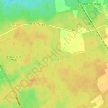
Name: Benoue topographic map, elevation, terrain.
Average elevation: 135 m
Minimum elevation: 113 m
Maximum elevation: 143 m
Other topographic maps
Click on a map to view its topography, its elevation and its terrain.
La Rousselliere
France > Centre-Val de Loire > Loir-et-Cher > Vouzon
La Rousselliere, La Rousselière, Vouzon, Romorantin-Lanthenay, Loir-et-Cher, Centre-Val de Loire, France métropolitaine, 41600, France
Average elevation: 132 m