
Thank you for supporting this site ❤️
Make a donation
Make a donation
Gear up for your next adventure:
As an Amazon Associate, this site earns from qualifying purchases at no extra cost to you.
Marakavu topographic map
Click on the map to display elevation.
Thank you for supporting this site ❤️
Make a donation
Make a donation
Gear up for your next adventure:
As an Amazon Associate, this site earns from qualifying purchases at no extra cost to you.
About this map
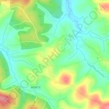
Name: Marakavu topographic map, elevation, terrain.
Location: Marakavu, Pulpally, Sulthanbathery, Wayanad, Kerala, India (11.78628 76.13121 11.80311 76.16555)
Average elevation: 769 m
Minimum elevation: 734 m
Maximum elevation: 828 m
Thank you for supporting this site ❤️
Make a donation
Make a donation
Gear up for your next adventure:
As an Amazon Associate, this site earns from qualifying purchases at no extra cost to you.