
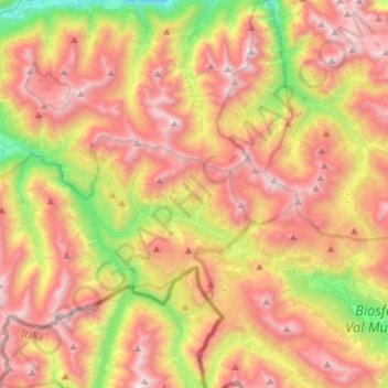
Parque Nacional Suíço topographic map
Interactive map
Click on the map to display elevation.
About this map
Name: Parque Nacional Suíço topographic map, elevation, terrain.
Average elevation: 2,283 m
Minimum elevation: 1,315 m
Maximum elevation: 3,153 m
Other topographic maps
Click on a map to view its topography, its elevation and its terrain.
Monte Serra
Monte Serra, Zernez, Region Engiadina Bassa/Val Müstair, Grisões, Suíça
Average elevation: 2,697 m