Geolocate

Miranorte topographic map

Click on the map to display elevation.

About this map
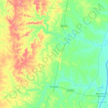
Name: Miranorte topographic map, elevation, terrain.

Location: Miranorte, Região Geográfica Imediata de Miracema do Tocantins, Região Geográfica Intermediária de Palmas, Tocantins, North Region, 77660-000, Brazil (-9.61600 -48.87300 -9.17500 -48.51000)

Average elevation: 291 m

Minimum elevation: 175 m

Maximum elevation: 568 m

Other topographic maps

Click on a map to view its topography, its elevation and its terrain.

Praia do Segredo

Brazil > Tocantins > Lajeado

Average elevation: 209 m

Campina Verde

Brazil > Tocantins

Average elevation: 271 m

Gear up for your next adventure:

🛰️Handheld GPS Units - Rugged GPS devices for tracking coordinates and elevation in the Australian bush
🧥Thermal Emergency Blankets - Compact Mylar blankets to prevent hypothermia if stranded overnight
🔪Camping Knives - Multi-purpose outdoor knives
🧥Packable Rain Jackets - Breathable waterproof layers for unpredictable mountain weather
🔑Heavy Duty Carabiners - Secure gear to the outside of your pack for easy access

As an Amazon Associate, this site earns from qualifying purchases at no extra cost to you.