
Mount Snow topographic map
Interactive map
Click on the map to display elevation.
About this map
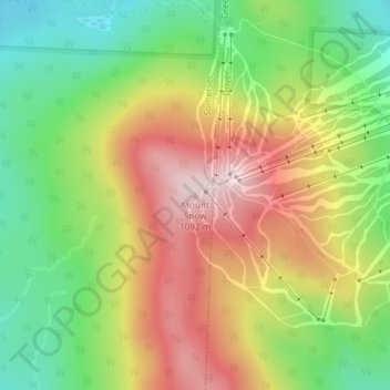
Name: Mount Snow topographic map, elevation, terrain.
Location: Mount Snow, Somerset, Windham County, Vermont, USA (42.95892 -72.92376 42.95902 -72.92366)
Average elevation: 865 m
Minimum elevation: 669 m
Maximum elevation: 1,091 m
Other topographic maps
Click on a map to view its topography, its elevation and its terrain.
Somerset Dam
Somerset Dam, Somerset, Windham County, Vermont, USA
Average elevation: 677 m