
Altmark topographic map
Interactive map
Click on the map to display elevation.
About this map
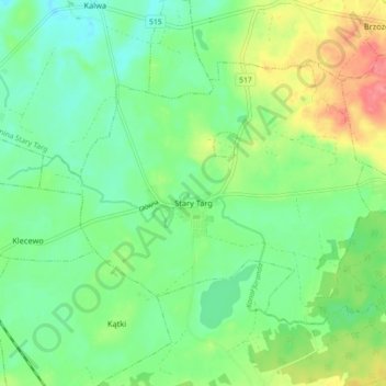
Name: Altmark topographic map, elevation, terrain.
Average elevation: 52 m
Minimum elevation: 25 m
Maximum elevation: 103 m
Other topographic maps
Click on a map to view its topography, its elevation and its terrain.
Vorwerk
Polen > Woiwodschaft Pommern > powiat sztumski
Vorwerk, Gemeinde Alt Christburg, powiat sztumski, Woiwodschaft Pommern, 82-450, Polen
Average elevation: 100 m