Geolocate

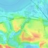
Swanscombe topographic map

Click on the map to display elevation.

About this map

Name: Swanscombe topographic map, elevation, terrain.

Location: Swanscombe, Dartford, Kent, England, DA10 0JB, United Kingdom (51.42370 0.28657 51.46370 0.32657)

Average elevation: 21 m

Minimum elevation: -7 m

Maximum elevation: 95 m

Other topographic maps

Click on a map to view its topography, its elevation and its terrain.
Wilmington

United Kingdom > England > Kent > Dartford > Wilmington

Average elevation: 47 m

Craylands Gorge

United Kingdom > England > Kent > Dartford > Swanscombe

Average elevation: 19 m

Bean

United Kingdom > England > Kent > Dartford > Bean

Average elevation: 52 m

Dartford Marshes

United Kingdom > England > Kent > Dartford

Average elevation: 4 m

Darenth

United Kingdom > England > Kent > Dartford > Darenth

Average elevation: 40 m

Wilmington

United Kingdom > England > Kent > Dartford > Wilmington

Average elevation: 47 m

Gear up for your next adventure:

📟Satellite Messengers - Two-way satellite communication to stay in touch beyond the cellular grid
📖Australian Bush Survival Books - Local knowledge on finding water and surviving the outback
🧊Insulated Cooler Bags - Keep food fresh for day trips to remote geographic sites
🔥Ferrocerium Rod Fire Starters - Reliable fire lighting in wet or windy conditions without matches
🧼Biodegradable Outdoor Soap - Clean gear and yourself without harming the local ecosystem

As an Amazon Associate, this site earns from qualifying purchases at no extra cost to you.