
Český Dub topographic map
Interactive map
Click on the map to display elevation.
About this map
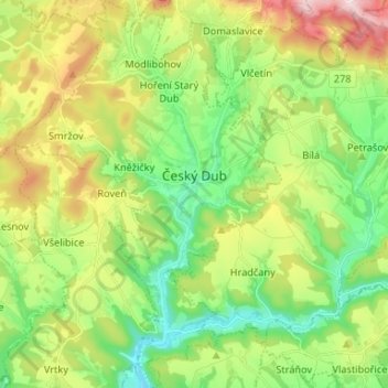
Name: Český Dub topographic map, elevation, terrain.
Average elevation: 389 m
Minimum elevation: 259 m
Maximum elevation: 616 m
Other topographic maps
Click on a map to view its topography, its elevation and its terrain.
Zdislava
Czechia > Northeast > Liberecký kraj
Zdislava, okres Liberec, Liberecký kraj, Northeast, 463 53, Czechia
Average elevation: 482 m
Liberec
Czechia > Northeast > Liberecký kraj
Liberec, okres Liberec, Liberecký kraj, Northeast, Czechia
Average elevation: 510 m