
Beverly topographic map
Interactive map
Click on the map to display elevation.
About this map
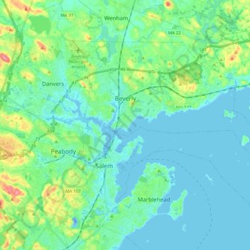
Name: Beverly topographic map, elevation, terrain.
Location: Beverly, Essex County, Massachusetts, United States (42.49394 -70.92234 42.59151 -70.72668)
Average elevation: 17 m
Minimum elevation: -19 m
Maximum elevation: 82 m
Other topographic maps
Click on a map to view its topography, its elevation and its terrain.
Highlands
United States > Massachusetts > Essex County > Haverhill > Highlands
Average elevation: 33 m