
Punta di Canannaccia topographic map
Interactive map
Click on the map to display elevation.
About this map
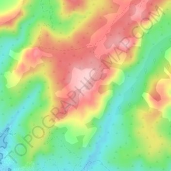
Name: Punta di Canannaccia topographic map, elevation, terrain.
Average elevation: 91 m
Minimum elevation: 0 m
Maximum elevation: 188 m
Other topographic maps
Click on a map to view its topography, its elevation and its terrain.
Capu di Senetosa
France > Corse > Corse-du-Sud > Sartène
Capu di Senetosa, Sartène, Corse-du-Sud, Corse, France métropolitaine, 20100, France
Average elevation: 11 m