
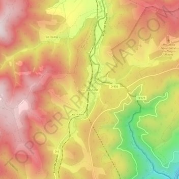
La Bastide topographic map
Interactive map
Click on the map to display elevation.
About this map
Name: La Bastide topographic map, elevation, terrain.
Average elevation: 1,084 m
Minimum elevation: 706 m
Maximum elevation: 1,329 m
Other topographic maps
Click on a map to view its topography, its elevation and its terrain.
Les Huttes
France > Occitanie > Lozère > La Bastide-Puylaurent > La Bastide
Les Huttes, La Bastide, La Bastide-Puylaurent, Mende, Lozère, Occitanie, France métropolitaine, 48250, France
Average elevation: 1,088 m
Masméjean
France > Occitanie > Lozère > La Bastide-Puylaurent
Masméjean, La Bastide-Puylaurent, Mende, Lozère, Occitanie, France métropolitaine, 48250, France
Average elevation: 1,143 m
Puylaurent
France > Occitanie > Lozère > La Bastide-Puylaurent
Puylaurent, La Bastide-Puylaurent, Mende, Lozère, Occitanie, France métropolitaine, 48250, France
Average elevation: 1,055 m