
Ugljan topographic map
Interactive map
Click on the map to display elevation.
About this map
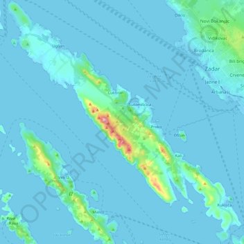
Name: Ugljan topographic map, elevation, terrain.
Location: Ugljan, Kali, Općina Kali, Gespanschaft Zadar, Kroatien (44.00941 15.06040 44.15872 15.26028)
Average elevation: 16 m
Minimum elevation: -3 m
Maximum elevation: 274 m